PHIVOLCS and GMA News Online have downloadable copy of The Valley Fault System Atlas on scribd . The higher-resolution copy is available for free download from the PHIVOLCS website. There is also a set of downloadable PDF files at The National Disaster Risk Reduction and Management Council website. Continue Reading
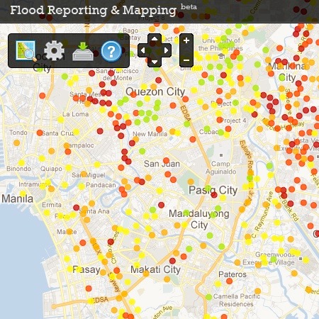
I've recently discovered some flood hazard maps at nababaha.com, a project by members of the Volcano-Tectonics Laboratory of the National Institute of Geological Sciences. According to their website:
"These hazard maps are indicative inundation maps for large flood events and useful only for knowing where not to be during extremely heavy rainfall. For local governments, these flood hazard maps can be used for localized emergency response (i.e. evacuation and access routes, road closures, siting of key rescue facilities) and for urban planning."
Take a look at the citizen reports at http://www.nababaha.com/report/view.php
The Metropolitan Manila Development Authority has identified the following flood-prone areas within Metro Manila:
Along H. Lopez Boulevard
Along R-10
Anda Circle
Taft Avenue corner Quirino Avenue
Along Abad Santos
Along G. Araneta Avenue
Mother Ignacia corner Bohol Avenue
Timog corner Scout Tobias
Along General Kalentong St.
P.Sanchez St. corner Fabella St.
Martinez St. corner F. Ortigas St.
Boni Avenue corner F. Ortigas St.
Edsa corner Connecticut
Chino Roces corner Edsa
Along Gil Puyat
Quirino Ave. Plaza
Airport Road and Naia Road
E. Rodriguez Jr. Avenenue corner Eagle Avenue
East Service road-Nichols Interchange
East Service road-DBM Avenue
Along C.P Garcia Avenue
Along Manuel L.Quezon Ave.
Along Commonwealth Ave
Along Tandang Sora and Ortigas Avenue in front of La Salle St.
I've started mapping the areas on Google Maps. The markings simply highlight the approximate points identified. They do not correspond to the actual area that's expected to flood as this information was not given.
View Manila flood areas in a larger map
This is a collaborative project so if you'd like to get involved, please contact me and I'll add you as a collaborator. Continue Reading
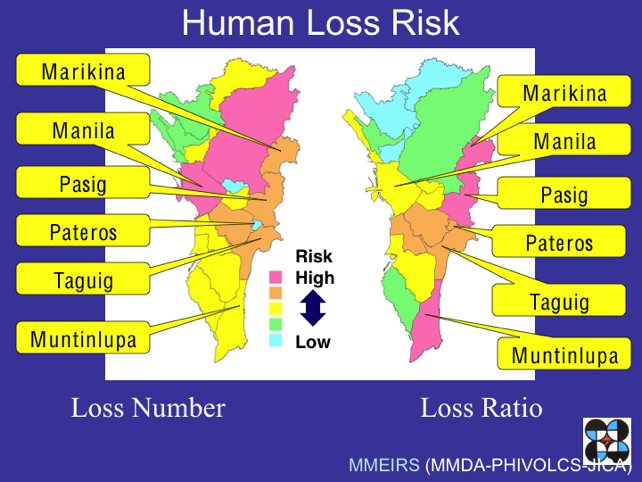
According to the 2004 Metro Manila Earthquake Impact Reduction Study, the West Valley Fault System is entering its active phases which may result in an earthquake of at least magnitude 7. Of the all the cities in Metro Manila, seven are highlighted as being most at risk of heavy damage and casualties in the event of a massive earthquake. These are:
Marikina
Quezon City
Pasig
Makati
Pateros
Taguig
Muntinlupa
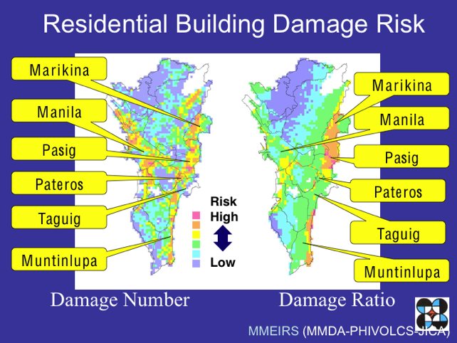
Since governmental disaster management systems will be insufficient to cope with the disaster, it's important that each of us take steps now to reduce its impact.
The maps below will help you assess how you could be affected should Manila be hit by a large earthquake. If you live or work in an area highlighted as having a higher risk, it would be wise to take extra precautions.
GMA News fault line map
GMANews.tv has produced an interactive map showing the Valley Fault System together with nearby landmarks. Hovering your mouse over the red fault line will highlight the landmarks within two kilometers of the fault.
 Images source: